GRASS GIS
7.8.5GRASS GIS: An accessible GIS application that lets you create maps, work with raster and vector objects, analyze geographical data and more
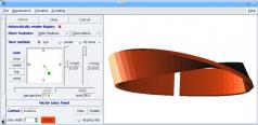
GRASS GIS is a robust Geographic Information System tool that enables you to analyze raster, vector, and point data, process images, perform geocoding, compare objects using the Map Swipe feature, as well as view and create maps.The application integrates with GDAL/OGR libraries which means it provides support for numerous raster and vector formats, allowing you to work with spatial data exported from other third-party tools but also save projects in various formats.
Should you have any trouble using this app, you can rely on a comprehensive set of tutorials, manuals and books that will teach you how to operate it.
Even if it’s packed with features, the interface of GRASS GIS is clean and practical, facilitating access to its functions.
Download Details
-
License:
Freeware
-
Platform:
Windows
- Publisher:
-
File size:
160.00 Mb
-
Updated:
Dec 28, 2020
-
User Rating:
0 / 5 (0 votes)
-
Editors' Review:
Not yet reviewed
-
Downloads:
2,570
Similar software
MathMod 11.1
A comprehensive application that can generate 3D models based on mathematical equations
36 / 2,535
2 / 668
ASDIP Retain 5.5.2.0
Calculate stability for overturning, sliding and bearing for retaining walls using this CAD application designed to deliver the best results in minimum time
15 / 2,806
Engauge Digitizer 12.1
An open source, digitizing software that converts an image file showing a graph or map, into numbers
76 / 7,987
Gwyddion 2.65
Efficient application for obtaining high-quality resolutions using different techniques.
4 / 875